The Latest
DASHBOARDS
SEVERE
Day 1 Outlook (SPC)
Day 2 Outlook (SPC)
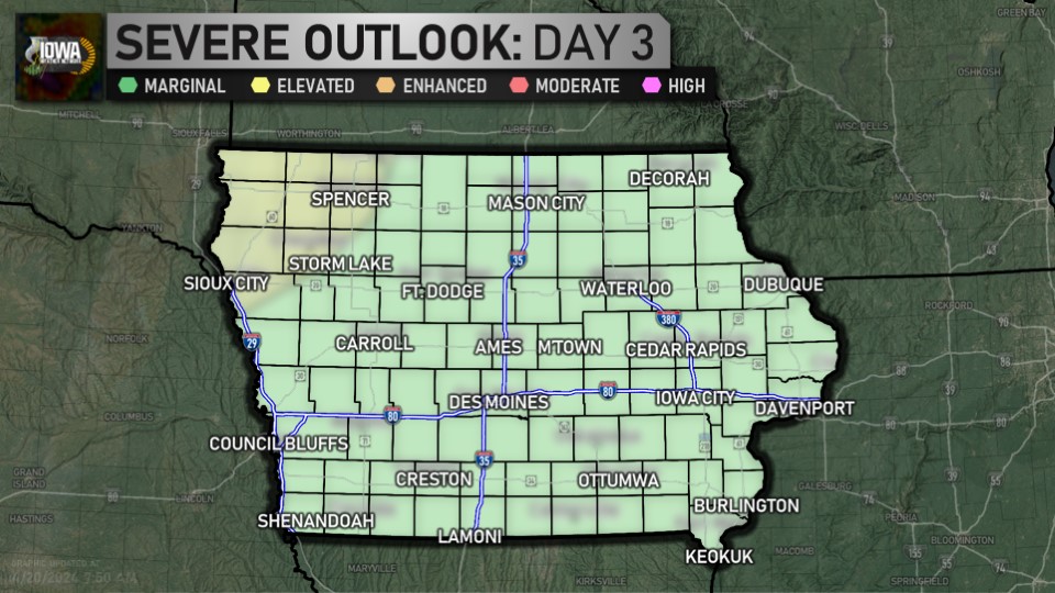
Day 3 Outlook (SPC)

Day 4-8 Outlook (SPC)
WINTER
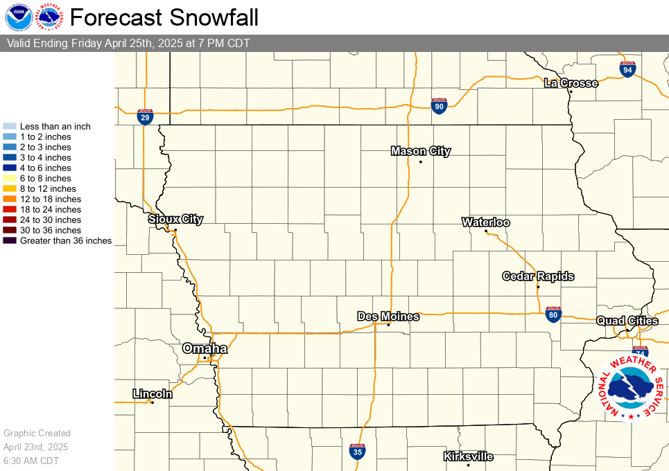
Latest Snowfall Forecast (NWS)
HYDROLOGIC
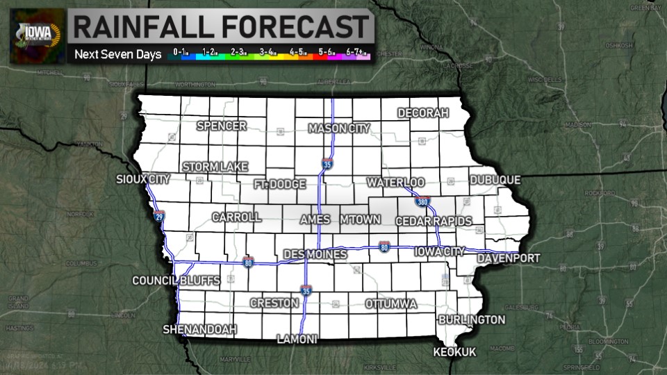
Latest Quantitative Precipitation Forecast (WPC)
DROUGHT
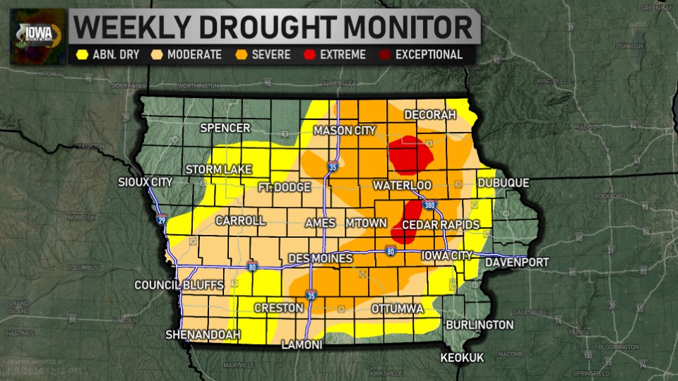
Latest Drought Monitor (CPC/NOAA/UNL)
FIRE WEATHER
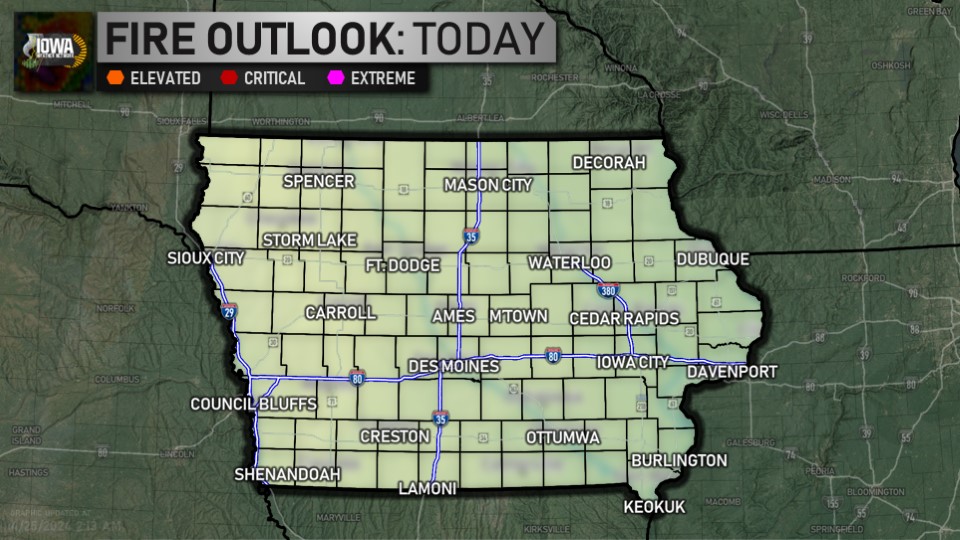
Day One Fire Danger Outlook (SPC)
CLIMATE
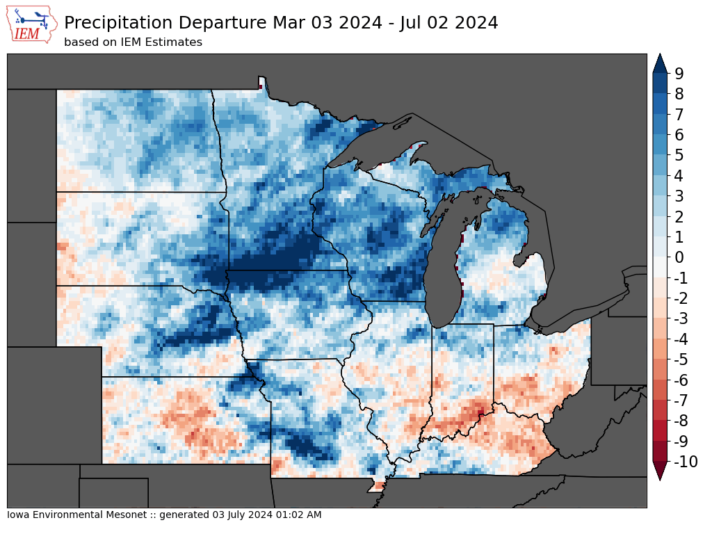
4 Month Precipitation Departures (IEM)
As we sit at the lunch-hour, here's the story out the window... temperatures range from 54 in Decorah and Hampton to 70 in Shenandoah. ... See MoreSee Less
0 CommentsComment on Facebook
It's morning over Waterloo... here's a look outside. The airport is reporting overcast and 58. ... See MoreSee Less
0 CommentsComment on Facebook
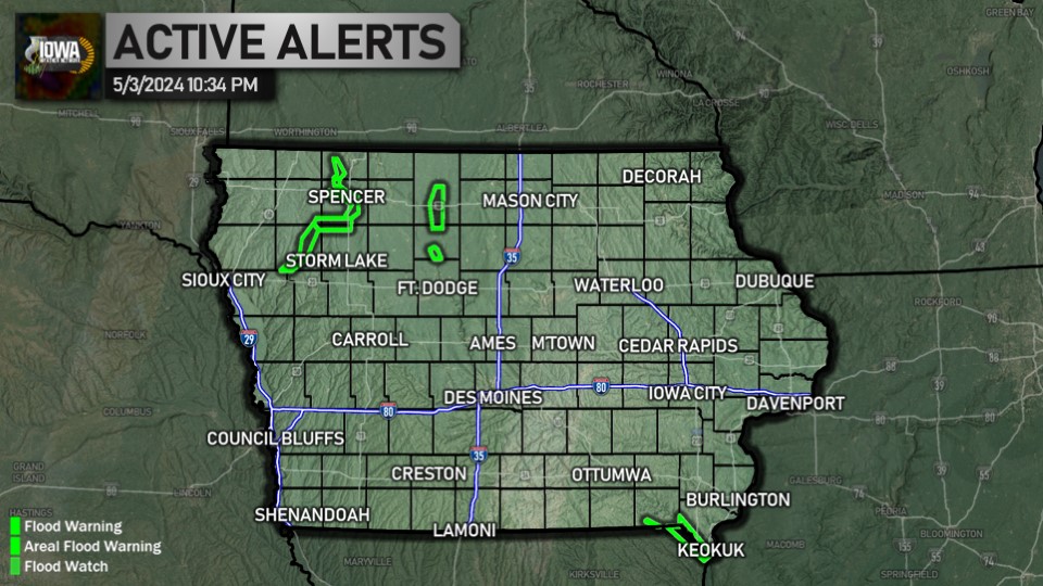
Drought monitor as of May 7:
▪️ Severe (D2): 19.35% (-2.93%)
▪️ Moderate (D1): 37.31% (-12.58%)
▪️ Abn. Dry (D0): 59.70% (-10.19%)
Latest info: iowawx.com/dss/drought ... See MoreSee Less
0 CommentsComment on Facebook
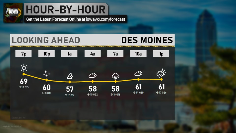
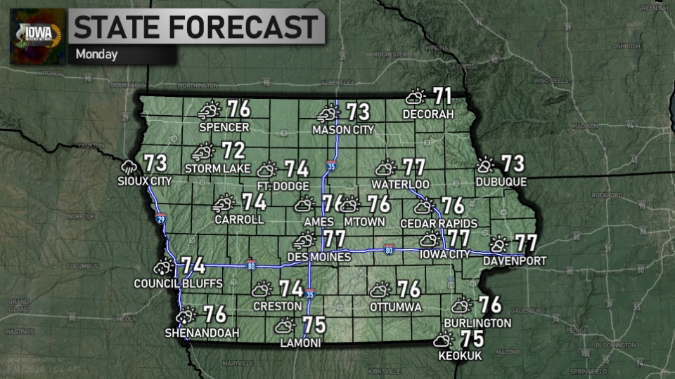
Looking ahead at the morning for Des Moines... get the latest forecast anytime at iowawx.com/forecast ... See MoreSee Less
0 CommentsComment on Facebook
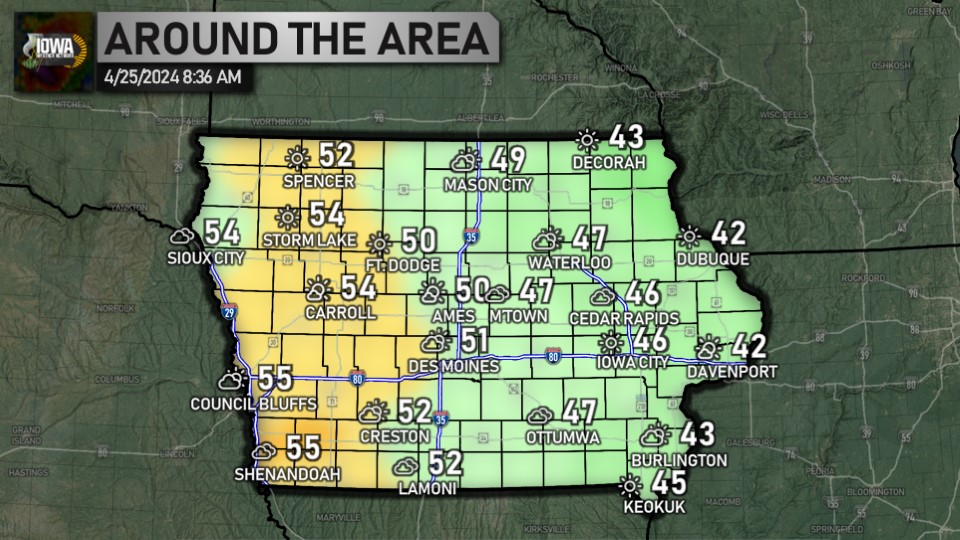
Welcome to Thursday, Iowa! Taking a look at the weather this morning, temperatures range from 48 in Denison to 61 in Keokuk. Have a great day! ... See MoreSee Less
0 CommentsComment on Facebook
It's after 5:30, which means it's time for a check of the radar and temperatures. Statewide, we're ranging from 45 in Denison to 62 in Burlington. ... See MoreSee Less
0 CommentsComment on Facebook
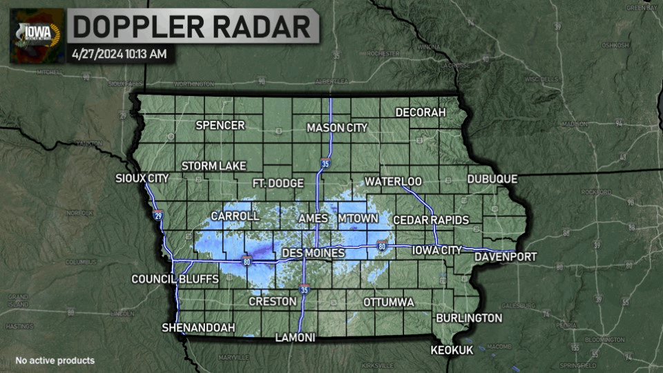
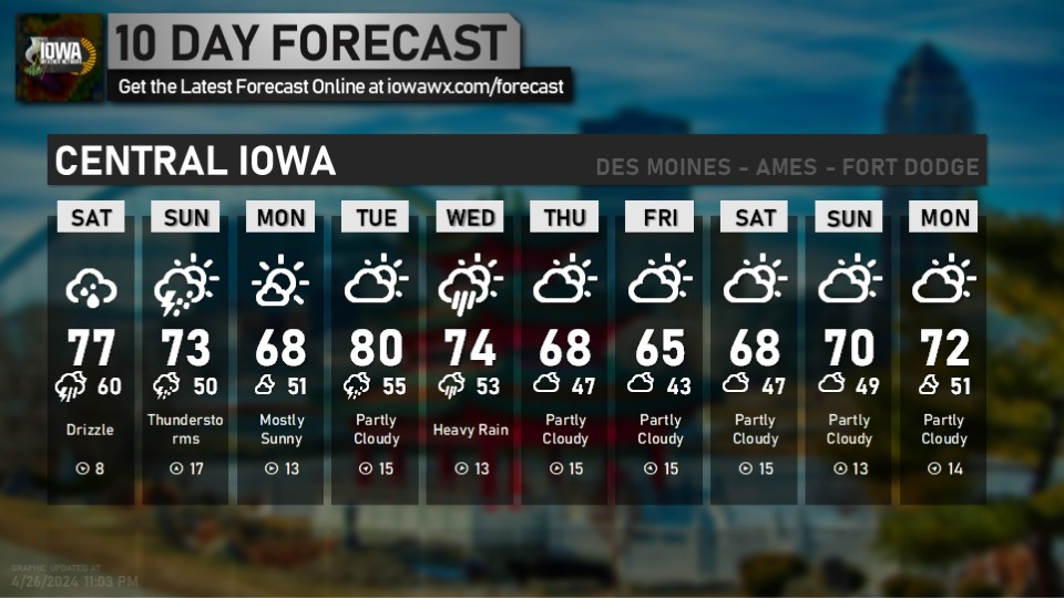
It's 10:00, which means it's time for the 10 at 10 for Des Moines. Get the forecast for all nine zones online at iowawx.com/forecast ... See MoreSee Less
0 CommentsComment on Facebook
Here's a look at the weather as we head into your Thursday. Full forecast available anytime at iowawx.com/forecast ... See MoreSee Less
0 CommentsComment on Facebook
Wednesday high temperatures: we ranged from 70 in Storm Lake to 83 in Quad Cities. ... See MoreSee Less
0 CommentsComment on Facebook