The Latest
DASHBOARDS
SEVERE
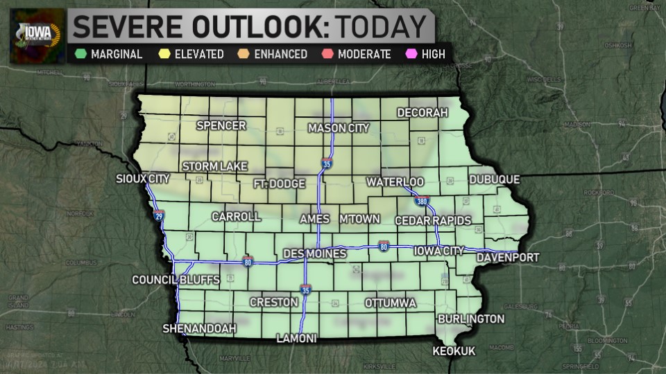
Day 1 Outlook (SPC)
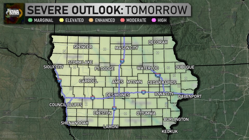
Day 2 Outlook (SPC)
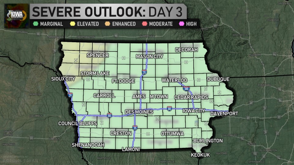
Day 3 Outlook (SPC)

Day 4-8 Outlook (SPC)
WINTER
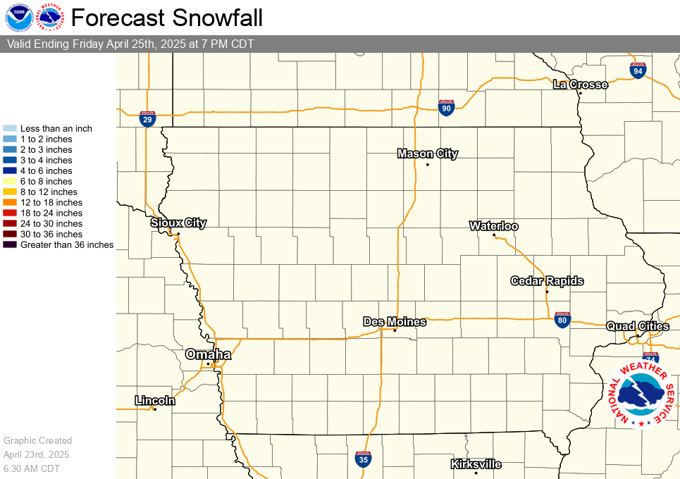
Latest Snowfall Forecast (NWS)
HYDROLOGIC
Latest Quantitative Precipitation Forecast (WPC)
DROUGHT
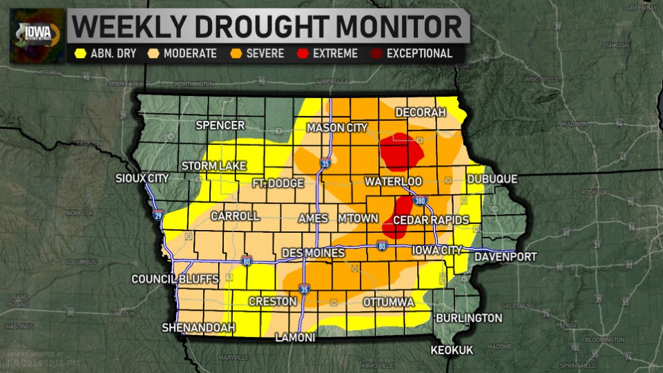
Latest Drought Monitor (CPC/NOAA/UNL)
FIRE WEATHER
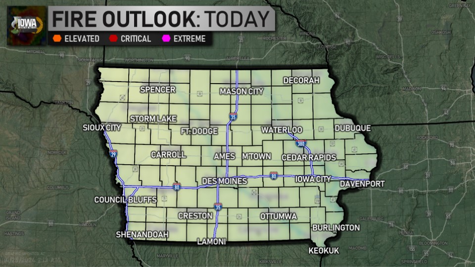
Day One Fire Danger Outlook (SPC)
CLIMATE
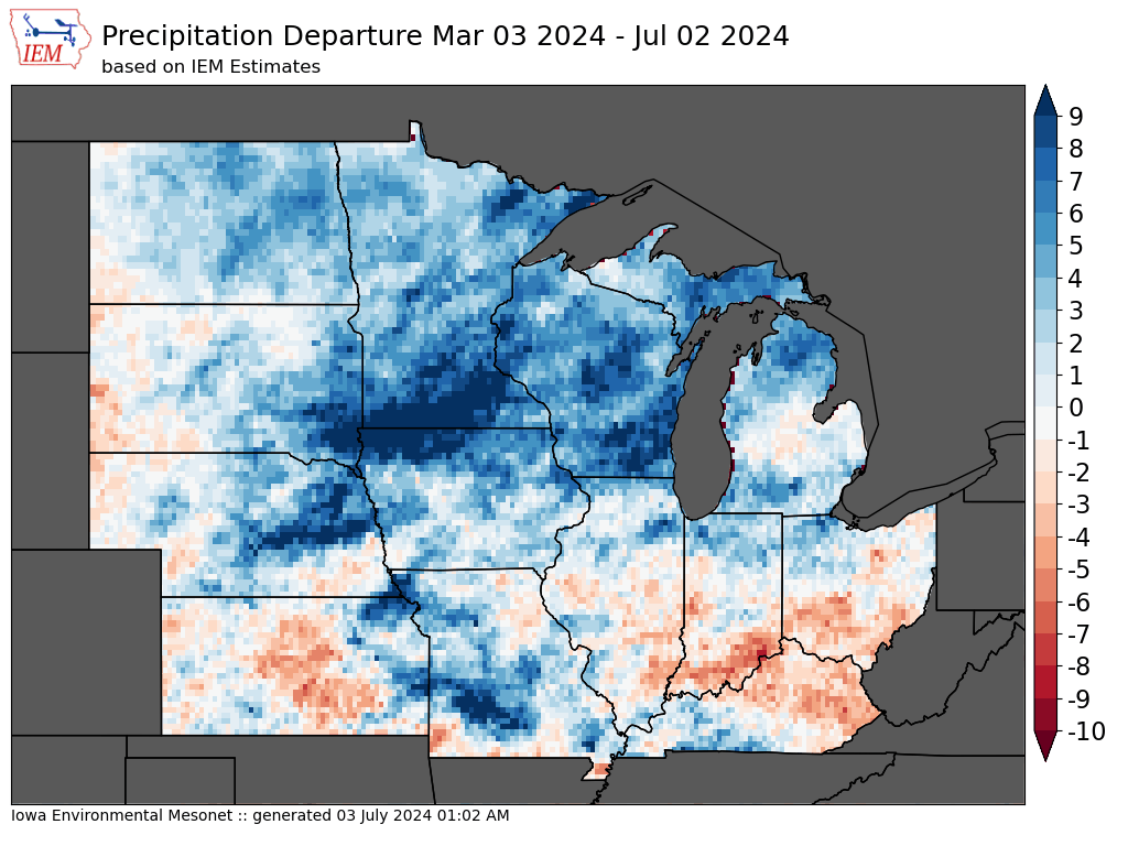
4 Month Precipitation Departures (IEM)
As we sit at the lunch-hour, here's the story out the window... temperatures range from 61 in Dubuque to 75 in Red Oak. ... See MoreSee Less
0 CommentsComment on Facebook
As we approach the noon hour on this Friday, here's an early look at your weekend weather forecast: ... See MoreSee Less
0 CommentsComment on Facebook
It's morning over Des Moines... here's a look outside. The airport is reporting mostly sunny and 61. ... See MoreSee Less
0 CommentsComment on Facebook
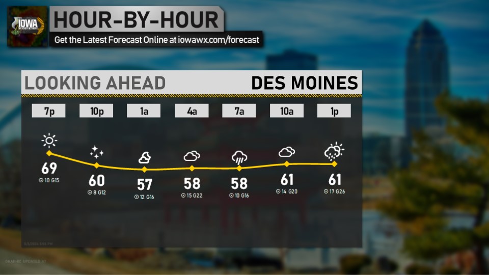
Looking ahead at the morning for Des Moines... get the latest forecast anytime at iowawx.com/forecast ... See MoreSee Less
0 CommentsComment on Facebook
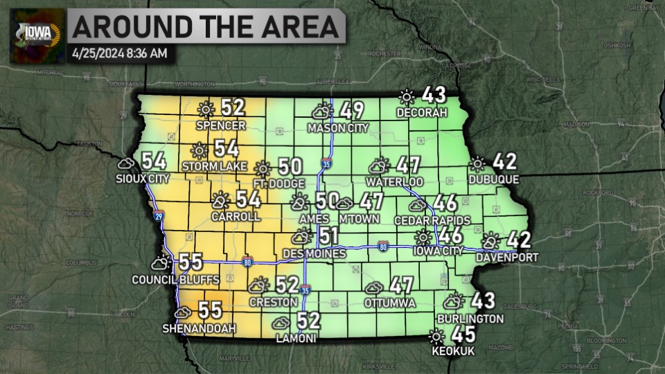
Happy Friday! We're almost to the weekend. As you head out the door this morning, temperatures range from 45 in Audubon, Denison, Forest City, and Harlan to 55 in Muscatine. Have a great day! ... See MoreSee Less
0 CommentsComment on Facebook
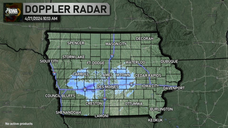
It's after 5:30, which means it's time for a check of the radar and temperatures. Statewide, we're ranging from 37 in Forest City to 54 in Burlington. ... See MoreSee Less
0 CommentsComment on Facebook
It's 10:00, which means it's time for the 10 at 10 for Des Moines. Get the forecast for all nine zones online at iowawx.com/forecast ... See MoreSee Less
0 CommentsComment on Facebook
Here's a look at the weather as we head into your Friday. Full forecast available anytime at iowawx.com/forecast ... See MoreSee Less
0 CommentsComment on Facebook
Thursday high temperatures: we ranged from 58 in Dubuque to 73 in Red Oak and Shenandoah. ... See MoreSee Less
0 CommentsComment on Facebook