The Latest
DASHBOARDS
SEVERE
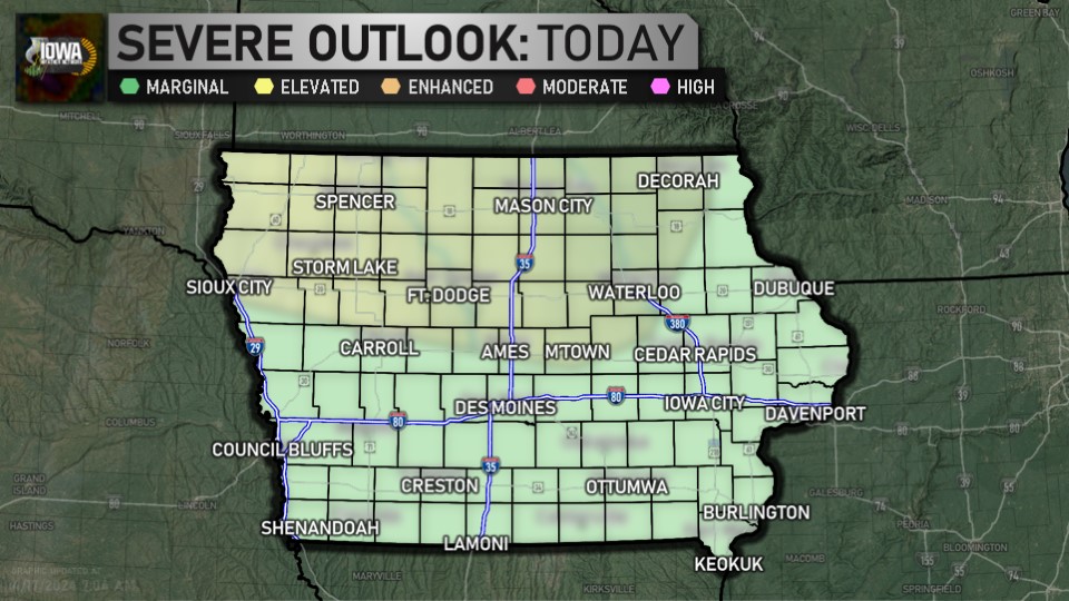
Day 1 Outlook (SPC)
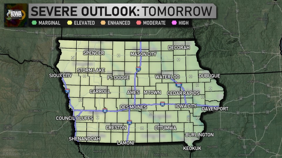
Day 2 Outlook (SPC)
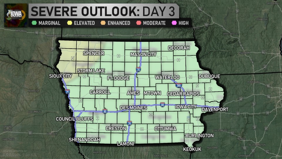
Day 3 Outlook (SPC)

Day 4-8 Outlook (SPC)
WINTER
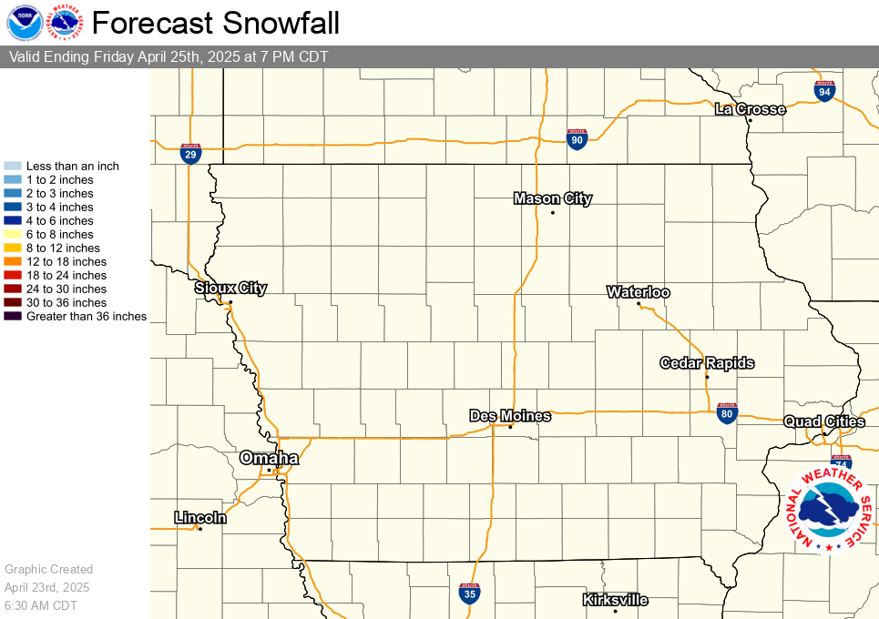
Latest Snowfall Forecast (NWS)
HYDROLOGIC
Latest Quantitative Precipitation Forecast (WPC)
DROUGHT
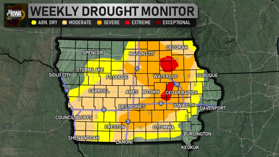
Latest Drought Monitor (CPC/NOAA/UNL)
FIRE WEATHER
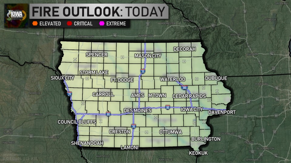
Day One Fire Danger Outlook (SPC)
CLIMATE
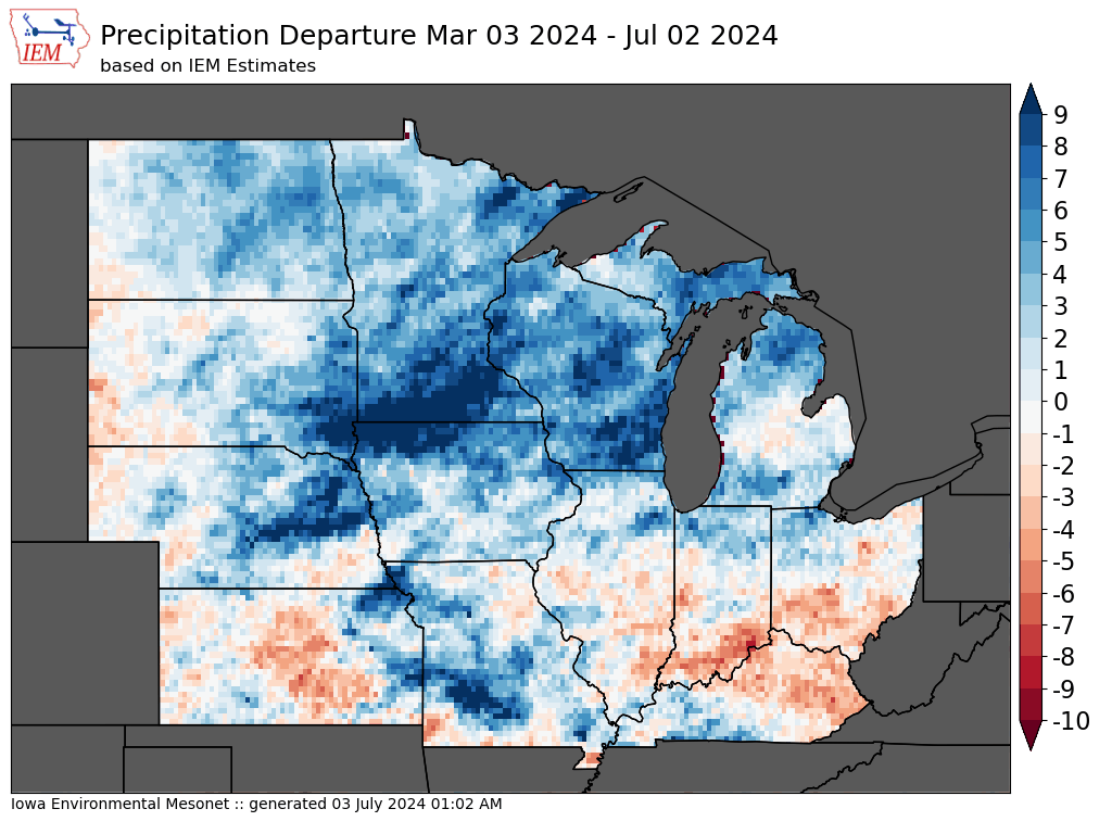
4 Month Precipitation Departures (IEM)
As we sit at the lunch-hour, here's the story out the window... temperatures range from 55 in Sioux City to 69 in Oskaloosa. ... See MoreSee Less
0 CommentsComment on Facebook
It's morning over Ames... here's a look outside. The airport is reporting mostly sunny and 56. ... See MoreSee Less
0 CommentsComment on Facebook
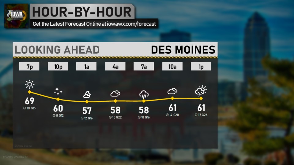
Looking ahead at the morning for Davenport... get the latest forecast anytime at iowawx.com/forecast ... See MoreSee Less
0 CommentsComment on Facebook
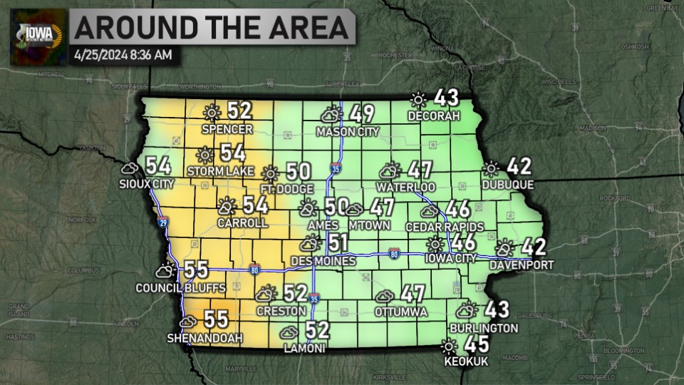
It's Wednesday. Here's how temperatures are looking: ranging from 44 in Sioux City to 57 in Fort Madison and Keokuk. Have a great day! ... See MoreSee Less
0 CommentsComment on Facebook
It's after 5:30, which means it's time for a check of the radar and temperatures. Statewide, we're ranging from 43 in Hampton, Sheldon, and Storm Lake to 61 in Keokuk. ... See MoreSee Less
0 CommentsComment on Facebook
It's 10:00, which means it's time for the 10 at 10 for Des Moines. Get the forecast for all nine zones online at iowawx.com/forecast ... See MoreSee Less
0 CommentsComment on Facebook
Here's a look at the weather as we head into your Wednesday. Full forecast available anytime at iowawx.com/forecast ... See MoreSee Less
0 CommentsComment on Facebook
A tornado warning has been issued for Van Buren county until 9:15 PM Tuesday. At 836 PM CDT, a severe thunderstorm capable of producing a tornado was located near Pulaski, or 9 miles southeast of Bloomfield, moving east at 40 mph. Take cover now! ... See MoreSee Less
0 CommentsComment on Facebook
A tornado warning has been issued for Davis county until 9:00 PM Tuesday. At 816 PM CDT, a severe thunderstorm capable of producing a tornado was located 5 miles southwest of Bloomfield Municipal Airport, or 6 miles southwest of Bloomfield, moving east at 40 mph. Take cover now! ... See MoreSee Less
0 CommentsComment on Facebook